WRF模拟的1980-2000年中国东北农业开发对气候的影响
Simulated effects of cropland extension on climate over Northeast China from 1980 to 2000 by WRF Model
WRF模拟的1980-2000年中国东北农业开发对气候的影响 |
| 张宏文, 张学珍, 张丽娟 |
|
Simulated effects of cropland extension on climate over Northeast China from 1980 to 2000 by WRF Model |
| Hongwen ZHANG, Xuezhen ZHANG, Lijuan ZHANG |
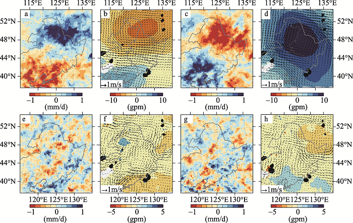
| 图6 东北地区夏季南旱北涝年景(a, b, e, f)和南涝北旱年景(c, d, g, h)下降水距平(a, c)、850 hpa高度场(彩色等值线图)和风场(箭头)距平(b, d)及土地利用/覆盖变化导致的降水量变化(e, g)和高度场(彩色等值线图)和风场变化(箭头)(f, h) |
| Fig. 6 Anomaly of summer precipitation (a, c) and geopotential height (color contours) and wind (arrows) at 850 hpa pressure level (b, d) and the changes in summer precipitation (e, g) and geopotential height (color contours) and wind (arrows) at 850 hpa pressure level (f,h) induced by Land use/cover changes (LUCC) in the South-Drought and North-Flood years (a, b, e, f) and South-Flood and North-Drought years (c, d, g, h) over Northeast China |
|
|