南海珊瑚礁高分辨率遥感地貌分类体系研究
Development of a geomorphic classification scheme for coral reefs in the South China Sea based on high-resolution satellite images
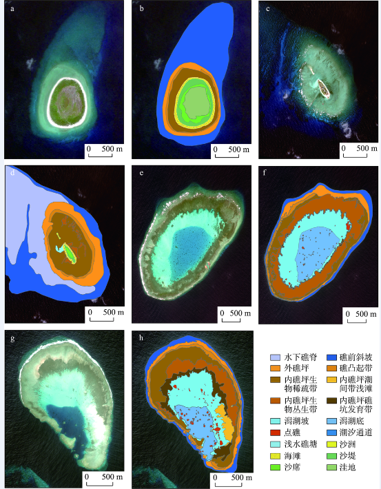
(a. 甘泉岛遥感影像 b. 甘泉岛地貌图 c. 敦谦沙洲遥感影像 d. 敦谦沙洲地貌图 e. 簸箕礁遥感影像 f. 簸箕礁地貌图 g. 安乐礁遥感影像 h. 安乐礁地貌图)
(a. Ganquan Island satellite image, b. Ganquan Island geomorphic map, c. Dunqian Cay satellite image, d, Dunqian Cay geomorphic map, e. Boji Reef satellite image, f. Boji Reef geomorphic map, g. Anle Reef satellite image, h. Anle Reef geomorphic map)