基于不透水面的中国县城建成区识别与时空演变研究
Identification and spatio-temporal variation of county towns' built-up area of China based on impervious surface dataset
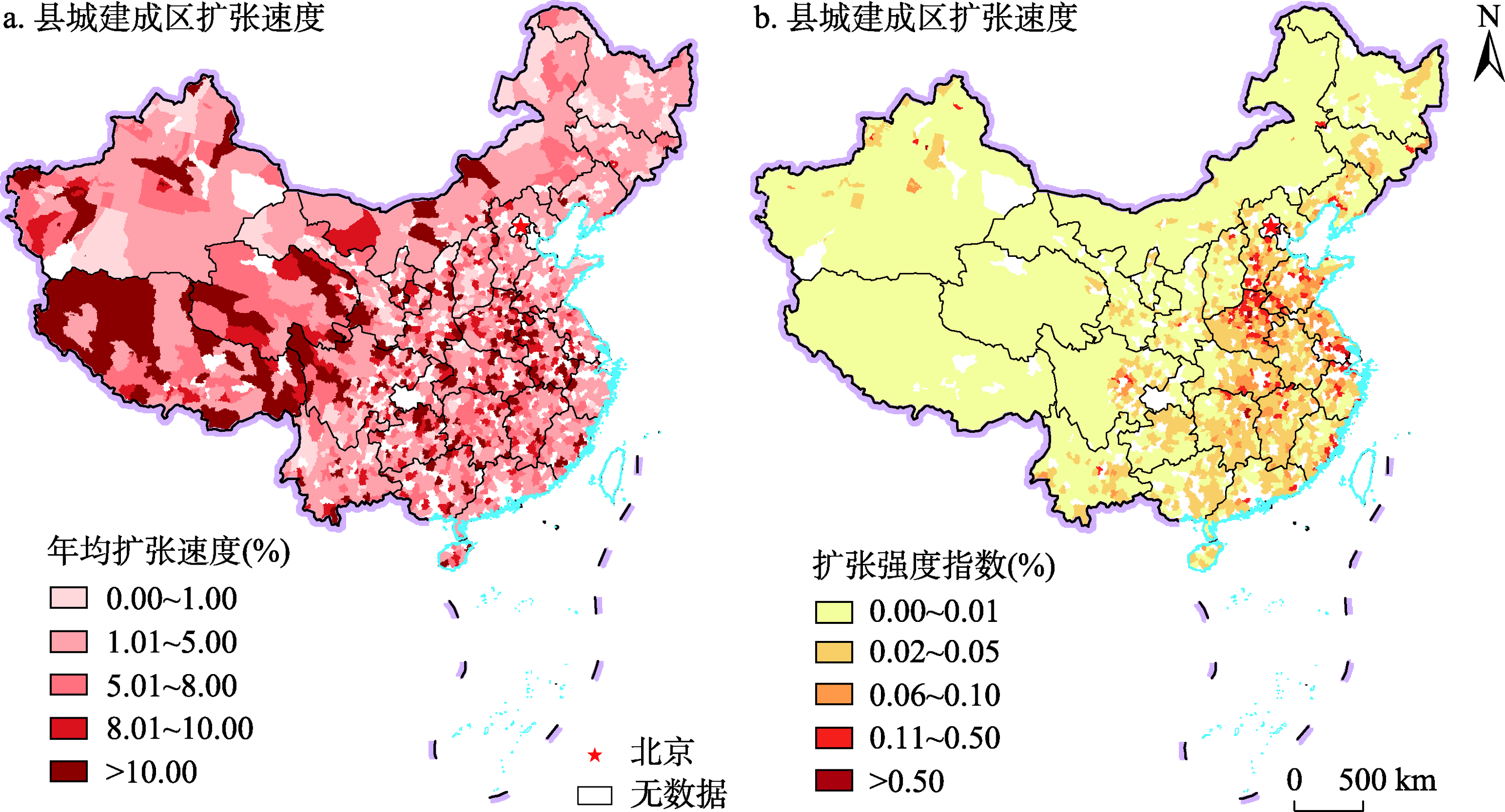
注:基于自然资源部地图技术审查中心标准地图服务网站的标准地图(审图号:GS(2019)1819号)绘制,底图边界无修改;为更好的显示效果,研究采取了县级行政区划展示县城建成区面积的地图表达形式。
基于不透水面的中国县城建成区识别与时空演变研究 |
| 尹旭, 魏慧, 李裕瑞 |
|
Identification and spatio-temporal variation of county towns' built-up area of China based on impervious surface dataset |
| YIN Xu, WEI Hui, LI Yurui |
| 图7 2010—2020年中国县城建成区扩张速度和扩张强度 注:基于自然资源部地图技术审查中心标准地图服务网站的标准地图(审图号:GS(2019)1819号)绘制,底图边界无修改;为更好的显示效果,研究采取了县级行政区划展示县城建成区面积的地图表达形式。 |
| Fig. 7 Map showing expansion rate and intensity of the county towns' built-up area in China from 2010 to 2020 |
|
|