
国土空间规划的用海分类体系探讨
|
段健(1986- ),女,湖南沅陵人,博士研究生。研究方向为土地利用、区域可持续发展。E-mail: duanj. 16b@igsnrr.ac.cn |
收稿日期: 2018-11-06
要求修回日期: 2019-09-06
网络出版日期: 2019-10-30
基金资助
国家自然科学基金重点项目(41630644)
中国科学院A类战略性先导科技专项(XDA230201)
版权
Discussion on marine classification system for territory spatial planning
Received date: 2018-11-06
Request revised date: 2019-09-06
Online published: 2019-10-30
Copyright
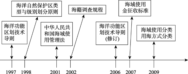
为建立健全统一衔接的空间规划体系,国家将“形成空间规划用海分类标准”列入了《省级空间规划试点方案》,并作为统一规划基础的重要任务之一。在总结评析中国现行用海分类体系特点及存在问题的基础上,结合空间规划和涉海部门对用海分类的要求,通过历史继承、类型细化和综合集成,提出了一套既希望服务空间规划、又能满足部门行业需求的基础性用海分类体系。研究建立的用海分类体系采用了海域用途功能-用海方式-属性特征相结合的三级分类层序结构,包括9个一级类、28个二级类和43个三级类;一级类和二级类继承了现行海域使用分类体系的层序架构和主要内容,增加的三级类吸纳和集成了用海方式分类体系和海域使用金征收标准用海类型划分体系的合理成分,重在突出海域使用的具体属性特征。进而以该分类体系为基础,阐释并归类了不同海洋功能空间的含义及用海类型构成,表明业已建立的空间规划用海分类体系具备作为“规范统一的基础性用海分类体系”的特质。
段健 , 徐勇 , 赵燊 . 国土空间规划的用海分类体系探讨[J]. 地理研究, 2019 , 38(10) : 2402 -2414 . DOI: 10.11821/dlyj020181221
In order to establish a sound and unified spatial planning system, the state has included "the marine classification standard for spatial planning" into the "Pilot Program of Provincial Space Planning" and listed it as one of the important tasks of the foundation of unified planning. On the basis of summarizing and analyzing the characteristics and existing problems of China's current marine classification system, and combined with the requirements of spatial planning and marine-related departments for the marine classification, this study proposed a basic marine classification system that not only satisfied service space planning but also met the needs of departmental industries by historical inheritance, type refinement and comprehensive integration. Based on the classification system, this paper explained and classified the meanings of different marine functional spaces and the composition of marine types. The main conclusions are as follows: (1) China's marine classification research started late, and the development process can be roughly divided into two periods: before and after 2001. Before 2001, the research was in its infancy, with academic inquiry as the mainstay and less achievements. Since 2001, the research has been driven by national needs and government actions. Aiming at different uses of various classification systems of marine utilization including marine space utilization, marine utilization way and marine function zoning have been established in succession. (2) Due to the differences in classification objectives, classification sequences, type composition, and type naming in China's current marine classification system, there is a lack of organic linkage among different classification systems, and the results and data are not comparable with each other, which not only restricts the integration and application of the results data, but also causes huge waste of manpower, material resources and financial resources. China's current marine classification system is still in the stage when multiple systems coexist, and has not yet formed a standardized and unified basic marine classification system. (3) This study established a marine classification system including 9 first-level types, 28 second-level types, and 43 third-level types for spatial planning by using a three-level classification sequence structure consisting of the functions of marine space, the way of marine utilization and attribute characteristics. The first-level and second-level types inherit the sequence structure and main content of the current marine space classification systems. The newly added three-level type absorbs and integrates the rational components of the marine classification system and standards for expropriation of marine space utilization fee, and focuses on the specific attribute characteristics of marine space utilization. (4) Based on the newly-developed marine classification system for spatial planning and aiming at spatial planning topics such as spatial planning, marine major function oriented planning, and marine function zoning, this study has carried out the classification of marine functional space by marine type, which indicates that the newly-developed marine classification system has the characteristics of "standardized and unified basic marine classification system".
表1 中国现行海域使用的分类体系Tab. 1 China's current classification system of marine space utilization |
| 一级类 | 二级类 | 一级类 | 二级类 | |||||||
|---|---|---|---|---|---|---|---|---|---|---|
| 编码 | 名称 | 编码 | 名称 | 编码 | 名称 | 编码 | 名称 | |||
| 1 | 渔业用海 | 11 | 渔业基础设施用海 | 5 | 海底工程用海 | 51 | 电缆管道用海 | |||
| 12 | 围海养殖用海 | 52 | 海底隧道用海 | |||||||
| 13 | 开放式养殖用海 | 53 | 海底场馆用海 | |||||||
| 14 | 人工鱼礁用海 | 6 | 排污倾倒用海 | 61 | 污水达标排放用海 | |||||
| 2 | 工业用海 | 21 | 盐业用海 | 62 | 倾倒区用海 | |||||
| 22 | 固体矿产开采用海 | 7 | 造地工程用海 | 71 | 城镇建设填海造地用海 | |||||
| 23 | 油气开采用海 | 72 | 农业填海造地用海 | |||||||
| 24 | 船舶工业用海 | 73 | 废弃物处置填海造地用海 | |||||||
| 25 | 电力工业用海 | 8 | 特殊用海 | 81 | 科研教学用海 | |||||
| 26 | 海水综合利用用海 | 82 | 军事用海 | |||||||
| 27 | 其他工业用海 | 83 | 海洋保护区用海 | |||||||
| 3 | 交通运输用海 | 31 | 港口用海 | 84 | 海岸防护工程用海 | |||||
| 32 | 航道用海 | 9 | 其他用海 | 90 | 其他用海 | |||||
| 33 | 锚地用海 | |||||||||
| 34 | 路桥用海 | |||||||||
| 4 | 旅游娱乐用海 | 41 | 旅游基础设施用海 | |||||||
| 42 | 浴场用海 | |||||||||
| 43 | 游乐场用海 | |||||||||
表2 中国现行海洋功能区划的分类体系Tab. 2 China's current classification system of marine function zoning |
| 一级功能区 | 二级功能区 |
|---|---|
| 农渔业区 | 农业围垦区、渔业基础设施区、养殖区、增殖区、捕捞区、水产种质资源保护区 |
| 港口航运区 | 港口区、航道区、锚地区 |
| 工业与城镇用海区 | 工业用海区、城镇用海区 |
| 矿产与能源区 | 油气区、固体矿产区、盐田区、可再生能源区 |
| 旅游休闲娱乐区 | 风景旅游区、文体休闲娱乐区 |
| 海洋保护区 | 海洋自然保护区、海洋特别保护区 |
| 特殊利用区 | 海底管线铺设区、路桥建设区、污水达标排放区、倾倒区 |
| 保留区 | 尚未利用的限制区 |
表3 空间规划用海分类体系Tab. 3 Classification system of marine utilization for spatial planning |
| 一级分类 | 二级分类 | 三级分类 | 含义 |
|---|---|---|---|
| 1渔业用海 | 指开展海洋渔业生产或保护海洋渔业资源所使用的海域 | ||
| 11围海养殖用海 | 指通过筑堤围海进而开展养殖生产的海域 | ||
| 111围海养殖海域 | 指筑堤围割海域用于人工养殖生产的海域 | ||
| 112重要苗种繁殖用海 | 指填海造地后用于重要苗种繁殖的用海 | ||
| 12开放式养殖用海 | 指在自然条件下开展养殖生产所使用的海域 | ||
| 121筏式养殖海域 | 指筏式人工养殖用海 | ||
| 122网箱养殖海域 | 指网箱人工养殖用海 | ||
| 123其他开放式养殖海域 | 指无人工设施和人工投苗,自然增殖生产海域 | ||
| 13人工鱼礁用海 | 130人工鱼礁用海 | 指通过构筑人工鱼礁开展增值养殖生产的海域 | |
| 2工矿用海 | 指开展工业、矿业生产所使用的海域 | ||
| 21工矿取水排水用海 | 指工业、矿业生产所使用的取水、排水海域 | ||
| 211工矿取水用海 | 指工业、矿业生产所使用的取水海域 | ||
| 212工矿排水用海 | 指工业、矿业生产所使用的排水海域 | ||
| 22固体矿产开采用海 | 指开采海砂及其它固体矿产资源所使用的海域 | ||
| 221海砂开采海域 | 指开采海砂所使用的海域 | ||
| 222其他固体矿产开采海域 | 指除海砂以外开采其它固体矿产资源所使用的海域 | ||
| 23 油气开采用海 | 指开采油气资源所使用的海域 | ||
| 231石油平台及储油设施用海 | 指油气开采平台、浮式储油装置用海 | ||
| 232油气开采其它附属设施用海 | 指油气开采用栈桥及其它附属设施用海 | ||
| 24 风电场用海 | 240 风电场用海 | 指风力发电设施用海 | |
| 25其他工矿业用海 | 250其他工矿业用海 | 指除上述以外的其它工矿业用海 | |
| 3交通运输用海 | 指为满足港口、航运、路桥等交通需要所使用的海域 | ||
| 31港池用海 | 310港池用海 | 指港池及开敞式码头前沿船舶靠泊和回旋水域 | |
| 32航道用海 | 320航道用海 | 指船只航行使用的海域,包括灯桩、立标及浮式航标灯等海上航行标志所使用的海域 | |
| 33锚地用海 | 330锚地用海 | 指船舶候潮、待泊、联检、避风及进行水上过驳作业等所使用的海域 | |
| 34跨海路桥用海 | 340跨海路桥用海 | 指跨海桥梁及其附属设施等的用海 | |
| 4旅游娱乐用海 | 指开发利用滨海和海上旅游资源,开展海上娱乐活动所使用的海域 | ||
| 41浴场用海 | 410浴场用海 | 指专供游客游泳或嬉水的海域 | |
| 42游乐场用海 | 420游乐场用海 | 指开展游艇、帆板、冲浪、潜水、水下观光及垂钓等海上娱乐活动所使用的海域 | |
| 5海底工程用海 | 指建设海底工程设施所使用的海域 | ||
| 51电缆管道用海 | 指埋(架)设海底通讯光(电)缆、电力电缆、深海排污管道、输水管道及输送其它物质的管状设施等所使用的海域 | ||
| 一级分类 | 二级分类 | 三级分类 | 含义 |
| 511通讯电缆用海 | 指海底有通讯电缆及附属设施布设的海域 | ||
| 512电力电缆用海 | 指海底有电力电缆及附属设施布设的海域 | ||
| 513输油管道用海 | 指海底有输油管道及附属设施布设的海域 | ||
| 514深海排污管道用海 | 指海底有排污管道布设的海域 | ||
| 515输水管道用海 | 指海底有输水管道布设的海域 | ||
| 52海底隧道用海 | 520海底隧道用海 | 指建设海底隧道及其附属设施所使用的海域 | |
| 53海底场馆用海 | 530海底水族馆用海 | 指建设海底水族馆及其附属设施所使用的海域 | |
| 54海底仓储用海 | 指建设海底仓库、储罐及其附属设施所使用的海域 | ||
| 541海底仓库用海 | 指建设海底仓库及其附属设施所使用的海域 | ||
| 542海底储罐用海 | 指建设海底储罐及其附属设施所使用的海域 | ||
| 6排污倾倒用海 | 指用来排放污水和倾倒废弃物的海域 | ||
| 61污水达标排放区 | 610污水达标排放区海域 | 指受纳指定达标污水的海域 | |
| 62倾倒区用海 | 620倾倒区用海 | 指倾倒区所占用的海域 | |
| 7填海工程用海 | 指为满足城镇建设、农业生产和废弃物处置需要,通过筑堤围割海域并最终填成土地 | ||
| 71城镇建设填海造地用海 | 710城镇建设填海造地 用海 | 指通过筑堤围割海域,填成土地后用于城镇(含工业园区)建设的海域 | |
| 72农业填海造地 用海 | 720农业填海造地用海 | 指通过筑堤围割海域,填成土地后用于农、林、牧业生产的海域 | |
| 73废弃物处置填海造地用海 | 730废弃物处置填海造地用海 | 指通过筑堤围割海域,用于处置工业废渣、城市建筑垃圾、生活垃圾及疏浚物等废弃物,并最终形成土地的海域 | |
| 8特殊用海 | 指透水构筑物,以及用于科研教学、军事、自然保护区、海岸防护工程等用途的海域 | ||
| 81透水构筑物用海 | 810透水构筑物用海 | 指采用透水方式构筑的码头、海面引桥、高脚屋、潜堤等所使用的海域 | |
| 82科研教学用海 | 指专门用于科学研究、试验及教学活动的海域 | ||
| 821科研及实验用海 | 指专门用于科学研究、试验的海域 | ||
| 822教学活动用海 | 指专门用于教学活动的海域 | ||
| 83军事用海 | 指建设军事设施和开展军事活动所使用的海域 | ||
| 831军事设施用海 | 指军事设施所使用的海域 | ||
| 832军事活动用海 | 指专门用于开展军事活动的海域 | ||
| 84海洋保护区用海 | 指各类涉海保护区所使用的海域 | ||
| 841海洋和海岸自然生态系统保护区 | 指海洋和海岸自然生态系统保护区涉及的海域 | ||
| 842海洋生物物种保护区 | 指海洋生物物种保护区涉及的海域 | ||
| 843海洋自然遗产和非生物资源保护区 | 指海洋自然遗产和非生物资源保护区涉及的海域 | ||
| 85海岸防护工程 用海 | 850海岸防护工程用海 | 指为防范海浪、沿岸流的侵蚀及台风、气旋和寒潮大风等自然灾害的侵袭,建造海岸防护工程所使用的海域 | |
| 9其他用海 | 91其他用海 | 910其他用海 | 指上述用海类型以外的海域 |
表4 海洋规划主题专用功能空间及用海类型构成Tab. 4 Special functional space and composition of the marine utilization types for different marine planning themes |
| 海洋规划主题 | 海洋功能空间 | 用海类型构成 |
|---|---|---|
| 空间规划 | 海洋建设空间 | 包括工矿用海、交通运输用海、海底工程用海、排污倾倒用海4个一级类,填海工程用海中的城镇建设填海造地用海、废弃物处置填海造地用海2个二级类,特殊用海中的透水构筑物用海、军事用海2个二级类 |
| 海洋农渔业空间 | 包括渔业用海1个一级类和填海工程用海中的农业填海造地用海1个二级类 | |
| 海洋生态空间 | 包括旅游娱乐用海、其他用海2个一级类,特殊用海中的科研教学用海、海洋保护区用海、海岸防护工程用海3个二级类 | |
| 海洋主体功能区规划 | 优化开发海域 | 包括排污倾倒用海1个一级类,填海工程用海中的废弃物处置填海造地用海1个二级类,工矿用海中的工矿排水用海1个三级类 |
| 重点开发海域 | 包括工矿用海(除工矿排水用海)、交通运输用海、海底工程用海、填海工程用海中的城镇建设填海造地用海等类型 | |
| 限制开发海域 | 包括渔业用海、其他用海2个一级类,填海工程用海中的农业填海造地用海1个二级类 | |
| 禁止开发海域 | 包括海洋保护区用海、海岸防护工程用海和旅游娱乐用海等类型 | |
| 海洋功能区划 | 农渔业区 | 包括渔业用海和填海工程用海中的农业填海造地用海 |
| 港口航运区 | 包括交通运输用海1个一级类 | |
| 工业与城镇用海区 | 包括工矿用海中的工矿取水排水用海和其他工矿业用海2个二级类,填海工程用海中城镇建设填海造地用海1个二级类 | |
| 矿产与能源区 | 包括工矿用海中的固体矿产开采用海、油气开采用海2个二级类 | |
| 旅游休闲娱乐区 | 包括旅游娱乐用海1个一级类 | |
| 海洋保护区 | 包括特殊用海中的海洋保护区用海1个二级类 | |
| 特殊利用区 | 包括海底工程用海、排污倾倒用海、特殊用海(除海洋保护区用海)、其他用海以及填海工程用海中的废弃物处置填海造地用海等类型 | |
| 保留区 | 其他海域 |
| [1] |
张云峰, 张振克, 张静 , 等. 欧美国家海洋空间规划研究进展. 海洋通报, 2013,32(3):352-360.
[
|
| [2] |
|
| [3] |
张宏声 . 海域使用管理指南. 北京: 海洋出版社, 2004.
[
|
| [4] |
周瑞荣, 许祝华, 张彦彦 . 对“海域使用分类体系” 的几点思考. 海洋开发与管理, 2009,26(3):71-77.
[
|
| [5] |
栾维新, 李佩瑾 . 海域使用分类定级与定价的实证研究. 资源科学, 2008,30(1):9-17.
[
|
| [6] |
|
| [7] |
国家技术监督局, 国家海洋局. 海洋功能区划技术导则(GB17108-1997), 1998 -05-01.
[ State Bureau of Technical Supervision, State Oceanic Administration. Technical Guidelines for Marine Function Zoning (GB17108-1997), 1998 -05-01. ]
|
| [8] |
国家技术监督局, 国家海洋局. 海洋功能区划技术导则(GB17108-2006), 2007 -05-01.
[ State Bureau of Technical Supervision, State Oceanic Administration. Technical Guidelines for Marine Function Zoning (GB17108-2006), 2007 -05-01.]
|
| [9] |
国家海洋局. 关于印发《海域使用分类体系》和《海籍调查规范》的通知(国海管字[2008]273号), 2008 -08-14.
[ State Oceanic Administration. Notice on Printing and Distributing the Classification System of Marine Space Utilization and Marine Investigation Norms([2008] No.273), 2008 -05-01.]
|
| [10] |
刘百桥, 阿东, 关道明 . 2011—2020年中国海洋功能区划体系设计. 海洋环境科学, 2014,33(3):441-445.
[
|
| [11] |
刘百桥, 赵建华 . 海域使用遥感分类体系设计研究. 海洋开发与管理, 2014,31(6):20-24.
[
|
| [12] |
中华人民共和国财政部, 国家海洋局. 关于加强海域使用金征收管理的通知(财综[2007]10号), 2007 -01-24.
[ Ministry of Finance of the People's Republic of China, State Oceanic Administration. Notice on Strengthening the Administration of the Expropriation of the Fee for The Utilization of Marine Space ([2007] NO. 10), 2007 -01-24.]
|
| [13] |
中共中央办公厅, 国务院办公厅. 省级空间规划试点方案(厅字[2016]51号) , 2016 -12-27.
[ The General Office of the CPC Central Committee, the General Office of the State Council. Provincial Spatial Planning Pilot Program ([2016] NO. 51), 2016 -12-27.]
|
| [14] |
全国人民代表大会常务委员会. 中华人民共和国海域使用管理法(国家主席令第六十一号), 2002 -01-01.
[ Standing Committee of the National People's Congress. Law of the People's Republic of China on the Utilization of Marine Space (State Presidential Decree No. 61), 2002 -01-01.]
|
| [15] |
国家技术监督局, 国家海洋局. 海洋自然保护区类型与级别划分原则(GB/T 17504-1998), 1999 -04-01.
[ State Bureau of Technical Supervision, State Oceanic Administration. Principles for the Classification of Marine Nature Reserves (GB/T 17504-1998), 1999 -04-01.]
|
| [16] |
国家海洋局. 关于印发《海籍调查规程》的通知(国海管字[2002]222号), 2002 -07-16.
[ State Oceanic Administration. Notice on Printing and Distributing the Regulations on Haishu Investigation ([2002] No. 222), 2002 -07-16.]
|
| [17] |
国家海洋局. 关于印发海域使用论证有关技术规程的通知(国海发[2008]7号), 2008 -08-14.
[ State Oceanic Administration. Notice on the Technical Regulations for the Issuance of Marine Space Utilization Arguments ([2008] No.7), 2008 -08-14.]
|
| [18] |
国家海洋局. 海域使用分类(HY/T 123-2009), 2009 -05-01.
[ State Oceanic Administration. Classification of Marine Space (HY/T 123-2009), 2009 -05-01.]
|
| [19] |
国家海洋局. 海籍调查规范(HY/T124-2009)], 2009 -05-01.
[ State Oceanic Administration. Regulations on Marine Investigation (HY/T124-2009), 2009 -05-01.]
|
| [20] |
曹可 . 浅谈海洋功能区划的性质和发展方向. 海洋开发与管理, 2008,25(8):19-24.
[
|
| [21] |
翟伟康, 张建辉 . 全国海域使用现状分析及管理对策. 资源科学, 2013,35(2):405-411.
[
|
| [22] |
国家海洋局908专项办公室. 海域使用现状调查技术规程. 北京: 海洋出版社, 2005.
[ The 908 Special Office of the State Oceanic Administration. Technical Regulations for the Investigation of the Status of Utilization of Sea Areas. Beijing: China Ocean Press, 2005.]
|
| [23] |
国家质量监督检验检疫总局, 国家标准化管理委员会. 地利用现状分类(GB/T21010-2017) , 2017 -11-01.
[ General Administration of Quality Supervision, Inspection Quarantine of P. R. C, Standardization and Administration of the People's Republic of China. Current Land Utilization Classification (GB/T21010-2017), 2017 -11-01.]
|
| [24] |
高月鑫, 曾江宁, 黄伟 , 等. 海洋功能区划与海洋生态红线关系探讨. 海洋开发与管理, 2018,35(1):33-39.
[
|
| [25] |
中华人民共和国国务院. 全国海洋主体功能区规划(国发[2015]42号) , 2015 -08-20.
[ State Council of the People's Republic of China. National Marine Main Functional Area Planning ([2015] No. 42), 2015 -08-20.]
|
| [26] |
中华人民共和国国土资源部. 全国海洋功能区划(2011—2020年) (国土资发[2012]19号), 2012-03-03.
[ Ministry of Land and Resources of the People's Republic of China. National Marine Function Zoning (2011-2020) ([2012] No. 19), 2012-03-03.]
|
| [27] |
福建省人民代表大会常务委员会. 福建省海域使用管理条例. 2016 -04-14.
[ Standing Committee of the Fujian Provincial People's Congress. Regulations on the Utilization of Marine Space in Fujian Province. 2016 -04-14.]
|
| [28] |
福建省人民政府. 福建省海洋功能区划(2011—2020年). 2012-10-01.
[ Fujian Provincial People's Government. Fujian Marine Function Zoning (2011-2020). 2012-10-01.]
|
| [29] |
刘洋, 丰爱平, 吴桑云 . 海洋功能区划实施评价方法与实证研究. 海洋开发与管理, 2009,26(2):14-19.
[
|
/
| 〈 |
|
〉 |